Google will partner with Dublin City Council to measure air quality levels across the city over a year-long project to help inform future clean air initiatives.
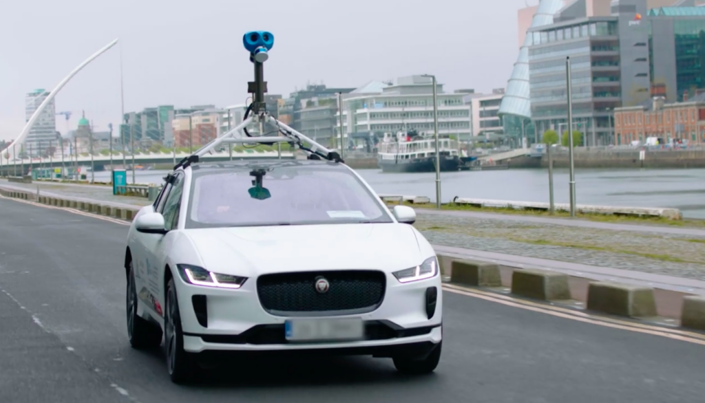
The Air View Dublin project will use a Google-equipped Street View car to drive the streets of Dublin and measure air quality levels. Maps will then be developed to produce a street level indication of pollutants and greenhouse gases across the city.
Google and Dublin City Council are hopeful that access to this data will encourage more people to join the conversation around air quality and enable people to make small but informed daily changes to contribute to its improvement.
This is the first time one of Google’s Jaguar I-Pace ‘zero tailpipe-emission’ electric cars will be used to collect air pollution data in addition to Google Maps Street View imagery.
The vehicle will use Aclima’s mobile air sensing platform to measure and analyse nitrogen dioxide, nitrogen oxide, carbon dioxide, carbon monoxide, particulate matter, and ozone. Aclima’s platform analyses and quality assures pollution measurements to develop maps of street-by-street air pollution in collaboration with Google and scientific research partners. These, in addition to air pollution insights, will be available for use by city authorities and by the public.
This forms part of the Smart Dublin project run by Dublin City Council which aims to inform smart transit programmes, reduce emissions, and promote cleaner transport.
The scheme was established Hazel Chu, the Lord Mayor of Dublin: ‘Dublin City Council is dedicated to fulfilling its commitment to the UN Breathe Life Campaign and it is projects like this that leverage innovation and forward thinking to allow us to make informed decisions for the benefit of our city and citizens.’
Project Air View was born from a clear and urgent need for hyperlocal insights on air quality and the overall objective of the initiative to make sure pollution data and insights available to cities and other governments, scientists, non-profit organisations, and the public.
Paddy Flynn, Vice President of Google Geo Operations, commented: ‘Air quality is a serious concern, especially for cities, but there is a gap in terms of localised data and insights available to decision makers. As part of this project, we’re using technology to capture this important data and make it accessible so that together with Dublin City Council, we can gain a deeper understanding of air pollution locally and provide important data to help drive solution planning. Mapping of street-by-street air pollution has never been captured or used in Ireland before, and our ultimate goal is that they will support new actions towards a cleaner, more sustainable Dublin.’
This comes after Google announced they will be launching a more eco-friendly Google Maps update that would automatically suggest a more fuel efficient routes, taking into account inclines and traffic, to help users reduce their environmental footprint.


